
Google Street View could be used to predict coronary heart disease risk by analysing neighbourhood environments, according to research.
A study, published in European Heart Journal, monitored everyday surroundings, including the quality of roads, buildings, and green spaces, and the role they play in determining heart health.
Researchers were able to track the link between these environmental elements, including the presence or absence of pollution, and the risk of coronary heart disease – a condition where the heart's arteries are blocked, limiting blood flow to the heart.
They found that these neighbourhood characteristics could account for 63 per cent of the differences in heart disease risk from one community to another.
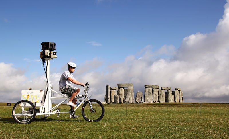
The discovery stems from analysing more than half a million Google Street View images across US cities, using computer vision to identify and interpret details that might go unnoticed by the human eye.
The data provides urban planners and public health officials with information to design healthier living spaces and neighbourhoods.
“Undoubtedly, there is a vast amount of demographic, social, economic and environmental data set,” said one of the study's authors, Prof Sanjay Rajagopalan from Ohio's University Hospitals Harrington Heart and Vascular Institute and Case Western Reserve University.
“However, there still remain substantial gaps in our knowledge regarding unique environmental aspects of data that are currently beyond human perception or interpretation.
“This is where the use of computer vision approaches may enable unparalleled understanding of the physical and built environment.”
The study included images of Detroit, Michigan; Kansas City, Missouri; Cleveland, Ohio; Brownsville, Texas; Fremont, California; Bellevue, Washington State, and Denver, Colorado.
By employing artificial intelligence, researchers have been able to examine the minutiae of neighbourhoods' built environment.
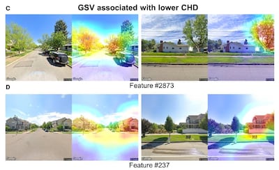
The study employed computer vision technology, including applications used in medical imaging and autonomous driving, to identify details and then interpret them to make predictions or decisions, as they do when estimating disease risks or navigating vehicles safely.
“We are getting to a place in human civilisation where utilisation of artificial intelligence to enhance human understanding is going to be critically important at solving complex problems,” Prof Rajagopalan said.
“Traditional approaches that have been used are rather limited as they are dependent on human and often linear interpretation of existing and highly curated unidimensional data sets.”